Best Photo Spots for Fagradalsfjall Volcano: 6 Locations Worth the Shot
The best photo spot for Fagradalsfjall is the Langihryggur ridge, the only viewpoint on the whole peninsula that frames the 2021, 2022 and 2023 lava fields in one shot. This page covers six named ground spots with GPS, exact best-light windows and what you actually get in frame, plus the shots you can only get from the air, since a hike photographs the texture of this landscape and a helicopter photographs its shape. I've walked every ground spot below more than once since April 2021, in the light that actually works and the crowds that actually show up, not the theoretical version other lists describe.
Quick answer
The best photo spot for Fagradalsfjall is the Langihryggur ridge, the only place that frames all three recent lava fields in a single image. Beyond that one viewpoint, this page covers the shots OF the volcano from six named ground spots and the shot you'll only get FROM the air on the helicopter flight.
Key takeaways
- #1 spot: Langihryggur ridge, via P2 Stóri-Leirdalur, the three-eruption view
- Full map with all six numbered spots further down this page
- The shot only the tour gets: the moss-boundary line and full crater row, visible from the helicopter, invisible from the ground
- Best overall timing: within the first hour after sunrise in summer, before the day's tour buses
- Bring: a fast shutter speed for the helicopter window and nothing fancier than boots for the ground spots
Photo Spots at a Glance
Every ground spot on this list, plus the one shot only the air gets you.
| Spot | Best time | The shot you get | How to get there | Fee |
|---|---|---|---|---|
| 1. Langihryggur ridge | Within 1 hour of sunrise | 2021, 2022 and 2023 lava fields in one frame | Trail C from P2, ~4 km, 1.5-2 h | Parking only |
| 2. Nátthagi lava front | Midday, flat light works fine | Close-up ropey crust, no crowd in frame | Trail A/yellow from P1, under 1 h | Parking only |
| 3. Geldingadalir crater viewpoint | Summer evening, sun still high | The 2021 crater rim above the valley it filled | Trail A from P1, 2-2.5 h | Parking only |
| 4. Meradalir valley | Long midsummer evening | The 2022 flow filling the whole valley floor | Trail E from P1, 5-6 h round trip | Parking only |
| 5. Litli-Hrútur | Early, before afternoon wind | The youngest lava, still bare of moss | Trail E from P1, full day | Parking only |
| 6. Sundhnúkur crater row | Late afternoon, low side light | The newest crater row above Grindavík | Minibus tour stop, or Trail B on foot | None extra on tour |
| From the helicopter | First clear flight of the morning | The whole flow field and moss boundary from above | Helicopter tour only | Ticket price |
Five of the six ground spots cost nothing beyond the standard 1,000 ISK parking fee, and only Sundhnúkur genuinely favours the tour over the trail. For a fuller sense of what the cooled lava actually looks like close up, beyond just the photo ops, see what you'll actually see at Fagradalsfjall now.
The exact clock times below shift through the year; treat this as a seasonal band, not a fixed time, and check a sunrise and sunset table for your specific date before an early start.
Most of these are reachable on foot, and the Fagradalsfjall volcano tours that stop for photographs build in time at the viewpoints.
| Season | Sunrise / sunset band | Best-light window |
|---|---|---|
| Late spring (April to May) | Sunrise climbing toward 4-5am, sunset stretching past 9pm | Early morning or late evening as daylight lengthens fast |
| Summer (June to August) | Sunrise as early as 2:55am on 21 June, sunset just after midnight | Within an hour of sunrise, or any time after 8pm; the sun barely sets |
| Autumn (September to October) | Sunrise sliding past 7am, sunset before 7pm by October | Standard early-morning or late-afternoon golden hour |
| Winter (November to March) | Sunrise near 11:20am around the solstice, sunset by 3:30pm | The whole short day sits in low-angle light; timing matters less than just going |
Map of the Best Photo Spots
All six numbered spots, matching the list below exactly. Blue pins are free and reachable on your own; the orange pin is easier as a tour stop than a solo hike.
The 6 Best Photo Spots
1. Langihryggur Ridge
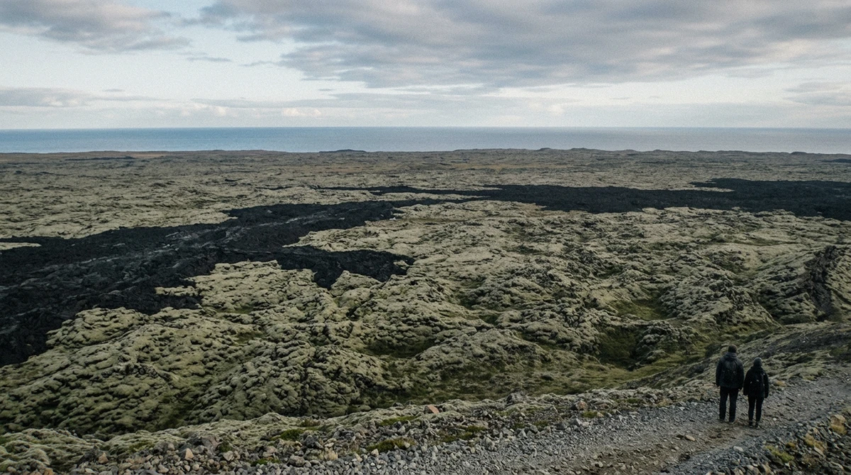
The shot: standing on the ridge you get the 2021 Geldingadalir flow closest to you, the 2022 Meradalir flow behind it, and a sliver of the 2023 Litli-Hrútur lava at the far edge, three separate eruptions and three different textures of black in one frame with nothing false about the composition. It's the single photograph that explains five years of eruptions faster than any caption could.
Best time: arrive within an hour of sunrise in summer, when the low side light rakes across the ridge and separates the flows by shadow rather than just colour. In June that means leaving P2 by around 4am for the 2:55am sunrise, less punishing than it sounds, since the sky never really goes dark.
GPS and access: the trail starts at P2 Stóri-Leirdalur, 63.8817, -22.2967, about 1 hour and 20 minutes' drive from central Reykjavík. Trail C climbs roughly 4 km one way from there, 1.5 to 2 hours of walking.
Rules and hazards: no permit, just the standard 1,000 ISK parking fee. The ridge has real exposure on one side, so watch your footing if you're backing up for a wider frame; this isn't a spot for a tripod near the edge in wind.
Fewer people choose P2 over P1, so this spot stays quieter even in August. If you'd rather see this ground with a guide who knows exactly where to stand, the small-group hike passes near enough to point you toward it.
2. Nátthagi Lava Front
The shot: a close, low frame of ropey black crust filling the picture, no ridge, no crowd, no sky if you don't want one. It's the texture shot, the one that shows the surface rather than the scale.
Best time: flat midday light actually works here, since the point is close-up detail rather than a long shadow across a landscape. That makes it the one spot on this list forgiving of a late start.
GPS and access: from P1 Geldingadalir, 63.8722, -22.3222, the yellow-marked path runs about 2 km one way and reaches the lava front in under an hour, the easiest walk of the six.
Rules and hazards: the same 1,000 ISK parking fee, no separate charge. Stay on the marked path rather than stepping onto the crust itself for a tighter shot; the ground can be hollow, and the reasons why sit in what actually makes this hazardous.
This is the spot I send anyone short on time, or hiking on their own for the first time. A wide-angle phone shot here, tight on the crust with a boot in frame for scale, reads better than most tripod setups further up the mountain.
3. Geldingadalir Crater Viewpoint
The shot: the 2021 crater itself, a dark cone above the valley it spent six months filling, 151 million cubic metres of it stretched out below the rim. This is the classic Fagradalsfjall photograph, the one most people mean when they picture this hike.
Best time: a summer evening beats a summer morning here, since the sun sits high enough at 9pm that you get the same quality of light with a quieter trail and no daytime tour buses crossing your frame.
GPS and access: the end of Trail A from P1, 63.8869, -22.2725, 2 to 2.5 hours of walking each way over ground that goes from gravel to lava crust as you climb.
Rules and hazards: parking fee only. The descent is where people slip in wet weather, more on gear for that on what to actually pack.
Crowds peak on summer weekend afternoons; an evening start, covered in more depth on the best time to visit, clears most of them out of your frame.
4. Meradalir Valley
The shot: the whole 2022 flow filling the valley floor from rim to rim, a wider, flatter composition than Geldingadalir's cone, better for a panorama than a portrait crop.
Best time: this only really works as a long midsummer evening trip, since the round trip via Trail E runs 5 to 6 hours; plan to be walking out while the light is still good, not racing dusk.
GPS and access: 63.8964, -22.2456, reached via Trail E from P1, 18 to 20 km round trip including Litli-Hrútur further on.
Rules and hazards: no permit beyond parking, but this is the one spot on the list that genuinely needs a full day, a full water supply and a weather window you trust from morning to evening, no shortcut once you've committed.
Because of the distance, this suits confident, well-prepared hikers rather than a casual add-on to another stop; pair it with an early start rather than an evening one unless you're doing the whole loop as one long midsummer day.
5. Litli-Hrútur
The shot: the youngest lava on the whole peninsula, still bare enough that reviewers describe no moss on it at all, the sharpest line anywhere between untouched ground and scorched rock.
Best time: go early, before any afternoon wind picks up on the exposed final stretch; this is the far end of an already long trail, and you want margin, not a race against fading light.
GPS and access: 63.9139, -22.2103, the far end of Trail E, effectively a full day's outing from P1.
Rules and hazards: the same parking fee, no other charge, but treat this as the most serious undertaking on this list: no checkpoint, no easy turnaround, and hours of exposed walking either way.
Pair this with Meradalir on the same outing rather than as a separate trip; you pass one to reach the other, and splitting them into two long days doubles the commitment for no real gain.
6. Sundhnúkur Crater Row
The shot: the newest crater row on the peninsula, the ground above Grindavík built up across nine eruptions between December 2023 and August 2025, cones in a visible line rather than one central peak.
Best time: late afternoon, when low side light picks out individual cones along the row rather than flattening them into a single dark mass.
GPS and access: 63.8804, -22.4495. On foot, Trail B reaches a viewpoint at 4.7 km from either car park, about 2 hours. The easier route by far is a stop on the the minibus route past the lava, which drives past Grindavík and the earth barriers on the way.
Rules and hazards: no separate fee on the tour version; self-drivers pay the standard parking charge for Trail B.
This is the one spot on the list I'd genuinely recommend the tour over the hike for, unless you're already doing Trail B for another reason; the driving route reaches a comparable vantage in a fraction of the time.
Photos From the Helicopter
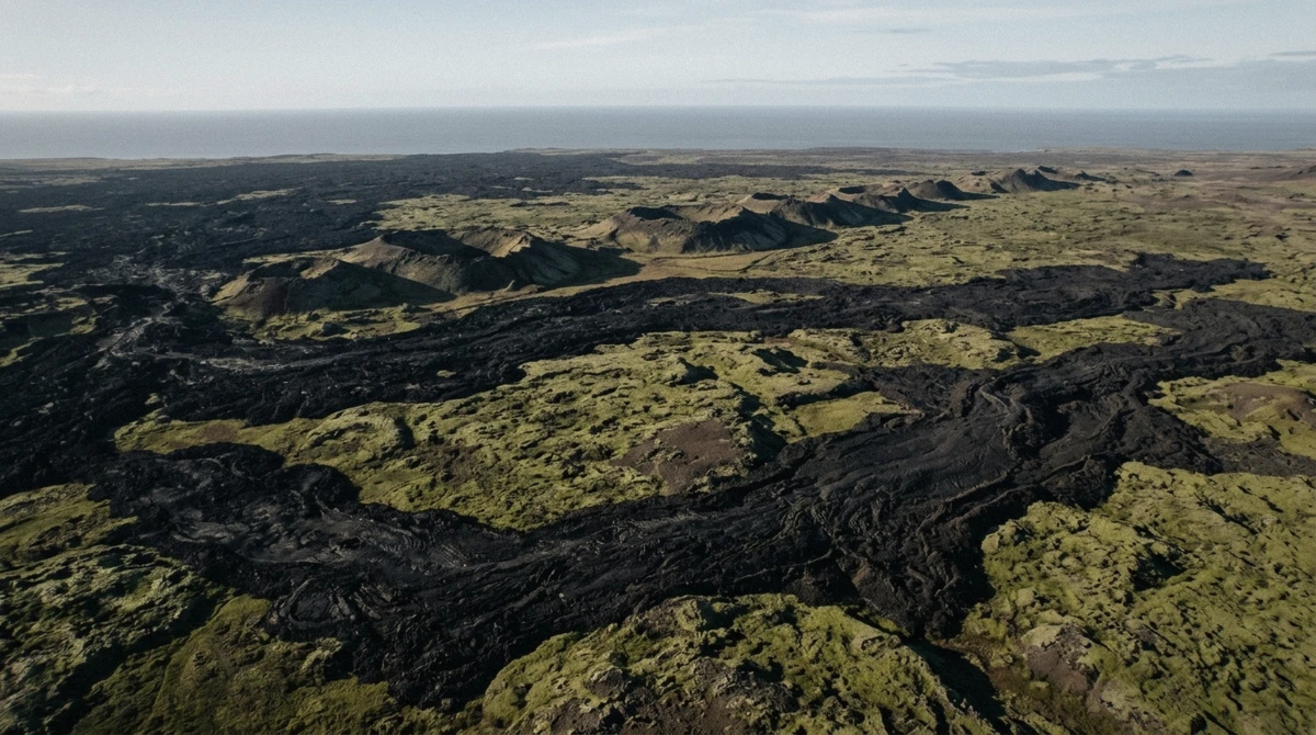
Every spot above photographs from eye level, close enough to feel the texture but too low to see the pattern. The helicopter flight is the other half of this page's promise: the shots you cannot get by walking, not because the ground spots are bad, they aren't, but because nothing on foot shows five years of overlapping eruptions as one continuous shape.
Where to sit and when: the cabin holds five or six seats and passengers rotate to the front at the stops, so ask early for a turn near the window regardless of which seat you start in. The clearest light is the first flight of a clear morning, before any afternoon haze builds over Faxaflói Bay.
Settings that actually matter: shoot at 1/1000s or faster to freeze motion through the window, since the aircraft's own vibration blurs anything slower even at a wide aperture. Keep the lens or phone case flat against the glass rather than angled, which cuts reflection more reliably than a polarising filter does at this angle.
What you get that no ground spot shows: the full Sundhnúkur crater row from directly above, the overlapping 2021 through 2025 flows in one continuous pattern, and the moss boundary that on the ground only appears underfoot; from the air it reads as a sharp green-to-black line across the whole valley. A passenger from Cyprus described that exact line as razor-sharp; from a trail you believe it, from the air you actually see the whole thing.
The honest trade-off: the helicopter flight costs more than three times the guided hike for a fraction of the time on the ground, and it's the only way to get the shape shot rather than the texture shot. If the ground spots above are enough for you, skip it. If you want the one photograph that shows what five years of eruptions actually built, book it.
Camera and Phone Settings That Work Here
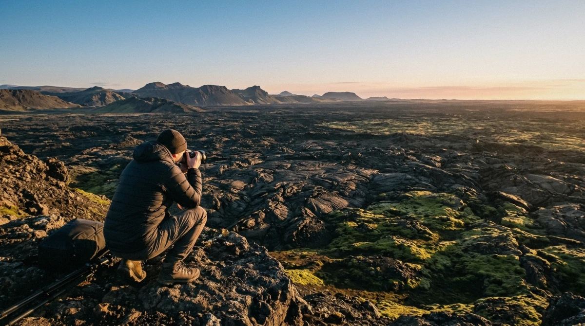
What I actually shoot this on: a mirrorless body with a 24-70mm for the wider ridge shots, and a phone for everything close to the crust, since a phone's smaller sensor handles the flat, low-contrast light here better than you'd expect.
Pre-dawn and late-evening light in summer is genuinely low even though it looks bright, so bump ISO before you bump shutter speed if you're shooting handheld on the descent; a blurred foreground from a slow shutter ruins more of these shots than visible grain does. Bring a spare battery regardless of season; cold cuts battery life faster than most travellers expect, even in a mild Icelandic July.
Wind, not water, is the lens hazard here. There's no spray to wipe off, but grit blown off the trail will scratch a lens wiped dry; carry a proper microfibre cloth rather than your sleeve.
Phone-only shooting: use portrait or pano mode for the wide ridge frames rather than digital zoom, which loses detail fast at this distance. Brace against a rock or your own knee rather than carrying a tripod; a tripod is genuinely impractical on the exposed sections and unnecessary at these shutter speeds in daylight.
On editing: the images on this page are lightly finished, not heavily saturated. What you see on the ridge in person reads closer to grey-black than postcard orange, so don't arrive expecting colours the actual rock doesn't have.
Rules, Etiquette and Drones
Personal photography is free everywhere on this list; nobody checks a permit for a phone or a personal camera on any of the six spots. Commercial or professional shoots, paid sessions, filming for a brand, are a different matter, and I don't have a confirmed permitting authority for the Reykjanes UNESCO Global Geopark to point you to here, so ask locally rather than assuming either way.
Tripods and monopods: nothing bans them on the ground spots, but the exposed sections, especially the Langihryggur ridge, make one genuinely impractical in wind rather than merely inconvenient. A monopod for stability without the wind-catching profile of a full tripod is the better compromise if you want one at all.
Drones: I don't have a confirmed local rule specific to this site to cite, and Iceland's national aviation authority governs drone use generally, so check the current rules before you fly rather than assume this page has the answer. What I can say plainly is that a drone anywhere near the helicopter's flight path is a real safety issue, not just an etiquette one, so keep well clear of the volcanic area during the daylight hours flights typically operate.
Which Tours Get You to These Spots
Spots 1 through 5 are reachable on your own, walked through in the self-drive guide if you want the driving and parking details rather than repeated here. Spot 6, the Sundhnúkur crater row, is easiest by the the minibus route past the lava, which stops near Grindavík and the earth barriers on its route. Neither guided hike, the geologist-led hike or the small-group hike, includes a professional photo package, though both guides will point out angles worth the extra minute if you ask.
The helicopter flight is the only way to get the aerial shot of the flow boundary, and it's worth booking specifically for that shot rather than as a substitute for the ground spots; the two show genuinely different things, not the same view from further away.
Six ground spots and one aerial one cover what this peninsula actually offers a camera, from close-up crust texture to the full shape of five years of eruptions. None of it needs more than a boot-worthy trail and a bit of patience for the light, except the one shot that only the helicopter gets. Check Fagradalsfjall volcano tours that stop for photographs once you know which spots you want.
Photo Spot Questions
What's the best place to photograph Fagradalsfjall?
The Langihryggur ridge, via P2 Stóri-Leirdalur, the only spot that frames the 2021, 2022 and 2023 lava fields together in one image.
Can you take photos during the guided hike?
Yes, both guided hikes stop for photos regularly, and neither restricts personal cameras or phones. Just stay on the marked path when you step off for a wider frame.
What's the best time of day for photos at Fagradalsfjall?
For the top spot, within an hour of sunrise in summer, when low side light separates the different lava fields by shadow. Other spots have their own windows, covered per spot above.
Should I bring a proper camera or is my phone enough?
A phone handles every ground spot well, especially the close-up crust shots at Nátthagi. A wider lens helps on the Langihryggur ridge, and a fast shutter matters more than gear quality for the helicopter window.
Are drones allowed near Fagradalsfjall?
There's no confirmed local rule specific to this site to point to, so check Iceland's current aviation rules before you fly. Keep well clear of the volcanic area during daylight hours regardless, since the helicopter operates then.
Do any Fagradalsfjall tours include professional photos?
No, neither guided hike nor the helicopter flight includes a photo package. What you get is a guide willing to point out an angle if you ask, not a photographer along for the ride.
Can I get these photos without a tour?
For five of the six spots, yes, all reachable on the marked trails with just the standard parking fee. The Sundhnúkur crater row is the one spot genuinely easier by tour than on foot.