What Will You See on a Fagradalsfjall Volcano Hike?
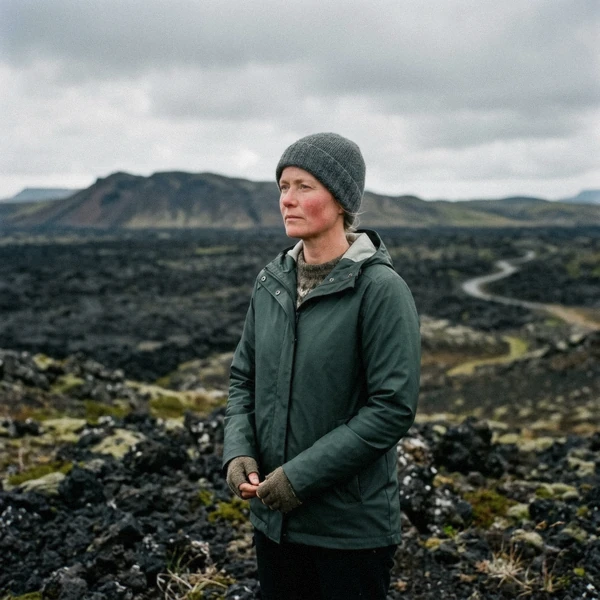
The honest version of what you'll see on a Fagradalsfjall volcano hike: cooled black lava almost every time, steam still rising from the cracks most trips, and on a clear day from Langihryggur ridge, three separate eruptions lined up in one view. What you won't see, unless a new eruption starts while you're in Iceland, is molten rock. I've walked this ground several times a season since April 2021, and the gap between what people expect and what's actually there is the single biggest thing worth clearing up before you book.
Quick answer
On a standard Fagradalsfjall hike you'll almost always see the cooled black lava crust and steam rising from cracks in it, very often the moss line marking where one eruption's ground stops and the next begins, and, on a good day from Langihryggur ridge, all three of the mountain's own eruptions in a single view. What you won't see, barring a new eruption, is anything glowing or flowing.
Key takeaways
- Nearly every trip: the 2021 lava crust itself, black, ropey and still faintly warm in cracks
- Most trips: steam venting from the rock and the moss line between the 2021 and 2023 fields
- Myth to drop: flowing or glowing lava belongs to 2021 news footage, not to a hike booked this month
- Lucky-day sight: an aerial view from the helicopter route, where the boundary between lava and untouched ground reads razor-sharp
- Best single viewpoint for photos: Langihryggur ridge, the only spot that shows all three Fagradalsfjall eruptions at once
- See the full likelihood table below before you decide what to expect
At a Glance: What You'll See and When
The honest calendar
Likelihood here means how often a sight actually shows up on a trip, not a guarantee. Read down the list in order; the top rows are close to certain, the bottom ones are a genuine bonus.
| Sight | Where at Fagradalsfjall | Best months | How likely |
|---|---|---|---|
| Cooled black lava crust | Trail A and Nátthagi, from P1 car park | Year round | Nearly every trip |
| Steam venting from cracks | Anywhere on the 2021-2023 flows, clearest on cold mornings | Year round, most visible October to April | Most trips |
| Crater viewpoint over Geldingadalir and Meradalir | Top of Trail A | June to September for clear skies | Most trips |
| The moss line between eruptions | Langihryggur ridge, Trail C | Year round | Most trips |
| Warmth through cracks in the rock | Newest sections of any flow | Year round | Regular but not every trip |
| Grindavík's earth barriers | On the minibus and volcano-circle route, not the hiking trails | Year round | Regular but not every trip |
| Three eruptions in one view | Langihryggur ridge only | Clear days, June to September | Regular but not every trip |
| Newest 2024-2025 lava near Sundhnúkur | Volcano-circle and minibus route near Grindavík | Year round | Regular but not every trip |
| Flowing or glowing lava | Nowhere, since 5 August 2025 | Not applicable | Rare |
| Razor-sharp aerial view of the lava boundary | Helicopter route only | Clear weather, any season | Lucky-day sighting |
| Aurora over the lava field | Any trail after dark | October to March | Lucky-day sighting |
What that table means for your visit
Everything in the top half of this table really comes down to whether you walk the trail at all; almost nobody who reaches the crater viewpoint comes back saying they saw nothing. The bottom two rows are genuinely down to luck, weather and which tour you book, not effort. The next sections walk site by site rather than sight by sight, so you know exactly where each one turns up.
| Tier | What's in it | Roughly how often |
|---|---|---|
| Almost every trip | Cooled crust, steam, crater viewpoint | Every trail that reaches the top |
| Most trips | Moss line, warmth through cracks, Grindavík barriers | Depends on the exact route and tour |
| Lucky-day | Flowing lava, the aerial boundary, aurora | Down to eruption status, tour type or weather |
Which Tour Shows You the Most?
If you just want the cooled crust and the steam
any of the guided hikes or the minibus loop covers it; this is the nearly-every-trip tier
If the three-eruption view is your priority
make sure your route includes Langihryggur ridge; it's the only spot that shows all three fields at once, so ask before booking or take Trail C yourself
If you want the sharp aerial boundary line
only the helicopter flight reaches it; no ground route shows the same razor-sharp edge
If the Grindavík story matters as much as the lava
book the small-group hike or a minibus loop; the hiking-only trails don't pass through town
If you're chasing aurora over the lava field
go between October and March on a clear night, and don't expect any daytime tour to deliver it
Almost Every Trip
The cooled lava crust
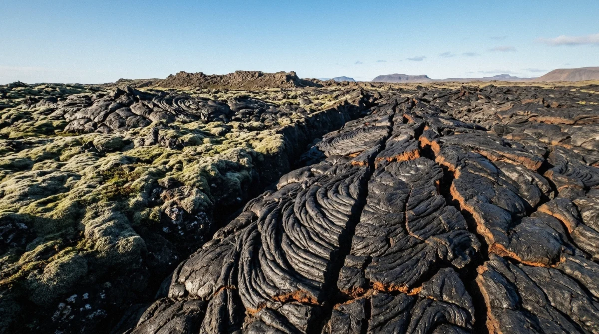
Black, folded, ropey rock in sheets and waves, nothing like a boulder field. Exact where: the marked edge of the 2021 flow, reached from P1 car park on Trail A or the shorter Nátthagi path. When: any day of the year the trail is open.
Likelihood: nearly every trip. The detail that surprises most first-timers is sound, not sight; the crust rings slightly hollow underfoot in places, which is also the reason nobody's supposed to walk on the unmarked sections.
Steam from the cracks
Look for thin, pale wisps rising straight up from fissures in the black rock, easiest to spot on a cold, still morning when the contrast against the air is sharpest. It shows up across the whole 2021-2023 flow, not one fixed spot. Likelihood: most trips, weather depending.
It isn't smoke; it's water vapour off ground that's still cooling four to five years after it stopped moving, and holding a hand near a vent, not on it, is often the first moment a hike stops feeling theoretical.
The crater viewpoint
From the top of Trail A you look down into Geldingadalir and across to Meradalir, the bowls the 2021 and 2022 eruptions filled. Best months: June to September, when clear skies happen often enough to count on the view. Likelihood: most trips reach it, since it's the natural end point of the standard route.
On the geologist-led hike, this is also where guides tend to slow down and point out which ridge blocked which flow, worth more than the view alone.
Most Trips
The moss line
A visible boundary where grey-green moss has started colonising the oldest 2021 rock and stops dead at the edge of the 2023 flow next to it, sharp enough to step across in a single stride. Exact where: best seen from partway up Langihryggur ridge, Trail C, about 4 km from P2 car park. When: no season matters here, the moss doesn't go anywhere.
Likelihood: most trips that take Trail C see it clearly; it's easy to miss from Trail A, which stays lower.
Warmth through the rock
Kneel near a crack on the newest ground and you can genuinely feel heat coming off it, not scalding, but noticeably warmer than the air. Exact where: sections of the 2023 Litli-Hrútur flow are the most reliable, since they're the youngest rock the standard trails reach. Likelihood: regular but not every trip, since it depends on which exact spot the group stops at.
One returning hiker described it as the closest thing to touching an eruption you'll get this year, and that's about right.
The Grindavík barriers
The earth walls built to steer lava away from the town and the Svartsengi plant, best seen on the minibus and volcano-circle routes rather than from the hiking trails, which don't pass through town. Likelihood: nearly every trip on those tours, rare on a hiking-only day. It's a heavier stop than the lava itself for a lot of visitors; you're looking at civil engineering built in a hurry to save a town, not scenery.
Lucky-Day Sights
Flowing or glowing lava
Say it plainly: this is the sight most people picture, and it isn't on offer right now. Nothing has erupted anywhere on the Reykjanes peninsula since 5 August 2025, and no guide, geologist or local, can promise a date for the next one. Likelihood: rare, in the sense of not currently possible outside a new eruption.
If that changes, the Fagradalsfjall volcano tours that reach the lava field would be the first place it gets reflected.
The razor-sharp aerial boundary
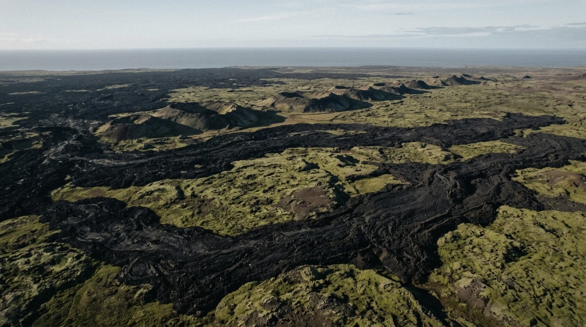
From several hundred feet up, on the helicopter flight, the line between the newest lava and untouched ground reads as genuinely razor-sharp, sharper than it looks from the ground. Likelihood: lucky-day in the sense that it's tied to one specific, pricier tour and a clear-weather day, not luck exactly, but not something the standard hike delivers. One passenger who flew this route in July described exactly that: no moss yet on the youngest rock, and the boundary between it and the old ground drawn like a line on a map.
Aurora over the lava field
Between October and March, on a clear, dark night, the northern lights sometimes show up over the black rock, a genuinely different picture than the daytime version of this hike. Likelihood: lucky-day, dependent on solar activity and clear skies same as anywhere else in Iceland, and not something any tour on this page runs specifically for. It's worth knowing about if you're already staying in the area through a winter evening.
Where Each One Lives
P1 car park and Trail A / Nátthagi
This is where most visitors see their first cooled lava and their first steam. Both the geologist-led hike and the small-group hike start here, and both reach the crater viewpoint at the top.
P2 and Langihryggur ridge
The moss line and the three-eruption view live here, on Trail C. Neither guided hike on this site takes this exact route by default, so it's more common among self-drivers and photographers than tour groups.
Grindavík and the Sundhnúkur route
The newest lava, the earth barriers and the evacuated town itself sit here, reached by the Reykjanes minibus tours rather than on foot from the Fagradalsfjall car parks. If seeing the most recent eruption's ground matters to you as much as the older fields, this is the piece a hiking-only day skips.
The air, on the helicopter route
The razor-sharp aerial view and the widest single look at how much ground five years of eruptions actually covered both live here, and nowhere else on this list. It's the one sight genuinely exclusive to a specific tour rather than a spot you could also reach on foot.
When to See Them
The short version
Nothing here runs on a migration schedule, since none of it is alive, but two things do shift with the seasons. Steam shows up more clearly against cold air, so October through April mornings tend to look more dramatic than a warm July afternoon even though the venting itself doesn't change. And the aurora sighting, if you're chasing it, only has a real window between October and March on a clear, dark night.
Everything else, the crust, the moss line, the crater view, looks essentially the same in January as it does in July, though the walking conditions absolutely don't. For the full month-by-month breakdown of daylight, temperature and which season actually suits the hike, see the full month-by-month breakdown for this hike.
What You Won't (Usually) See
The lava you're picturing isn't here anymore
The mix-up is understandable. Search for Fagradalsfjall and you'll still turn up 2021 footage of a fountain of orange lava that drew 350,000 visitors to a hillside, plus five years of evacuation headlines from Grindavík. None of that is currently happening.
The eruption that made the mountain famous ended in September 2021, Fagradalsfjall's own last eruption closed in August 2023, and the most recent activity anywhere on the peninsula, at a different crater row entirely, stopped on 5 August 2025. What you're walking across is the aftermath of all three, cooled and going quiet, not a live event. If the cooled version still sounds worth the trip, the honest verdict on the whole hike covers cost, downsides and who should skip it.
Responsible Viewing on the Lava Field
The one rule that matters
Stay off the lava itself and on the marked path; a crust that looks solid can be hollow, and rock beneath a young flow can still sit close to 1,200 degrees Celsius. Don't take rock samples home, and don't build cairns or write in the ash, since the ground is the whole point of the visit for the next person too. If sections of the trail are roped off or closed, that's usually a gas reading, not caution for its own sake, so treat it as a hard stop rather than a suggestion.
Hazards to Know
Gas, briefly
The real hazard on a quiet lava field is sulphur dioxide pooling in hollows when the wind drops, not the rock itself. Check the forecast the morning you go and leave if you smell sulphur or feel your chest tighten; it clears fast once you're upwind.
How to Maximize What You See
What I've learned from going back every season
A few things genuinely change how much of this you actually notice, beyond just showing up.
- Go early. The car parks fill by mid-morning in July and August, and an early start also means better light for photos at the crater viewpoint.
- Walk quiet for a stretch. Stop talking for two minutes near a steam crack and you'll hear the ground more than you expect to.
- Ask the guide to point out the moss line specifically if you're on a guided hike; it's easy to walk past without someone naming it.
- Pick a cold, still morning over a warm one if steam is what you want to photograph; the contrast against the air makes a real difference.
- Take Langihryggur ridge, not just Trail A, if the three-eruption view matters to you; it's the only spot that shows all of it at once.
- For families, the cooled crust and the steam cracks are the easiest and safest things for a child to spot; save the ridge walk for older kids who can manage the extra distance.
- If your budget stretches to it once, the helicopter flight shows you a scale that nothing on foot can match, the sheer size of what three eruptions actually covered.
What You'll See Questions
Will I see molten or glowing lava on a Fagradalsfjall hike?
No, not right now. Nothing has erupted on the peninsula since 5 August 2025, and no operator can promise a date for the next one. What you'll see instead is the cooled, black result of three eruptions, still venting steam in places.
What's the most common thing you'll see on the Fagradalsfjall hike?
The cooled lava crust itself, on nearly every trip that reaches the trail, plus steam rising from cracks in it on most days.
Are there dangerous hazards on the cooled lava field?
The main one is sulphur dioxide gas, which pools in hollows when the wind drops. Check the forecast before you go, stay on the marked path, since the crust can be hollow, and leave if you smell sulphur.
Can I touch or walk on the lava?
No. Stay on the marked trail; the crust over a young flow can be hollow and rock beneath it can still run close to 1,200 degrees Celsius.
What's the rarest thing you might see at Fagradalsfjall?
Aurora over the black lava field on a clear winter night, or the razor-sharp aerial view of the lava boundary from the helicopter route. Both are genuine bonuses, not something a standard hike promises.
Do I need a helicopter tour to see the moss line and the lava boundary, or is the standard hike enough?
The standard hike is enough for the moss line itself, best seen from Langihryggur ridge. The helicopter adds a sharper, aerial version of the same boundary and a sense of scale the ground route can't match, but it's an addition, not a requirement.
What's the best month to see steam rising from the lava?
Any month works, but a cold, still morning between October and April tends to show it more clearly against the air than a warm July afternoon does. Our full month-by-month guide covers the rest of the seasonal picture.